
Davidson County ZIP Code Coverage
The November 2017 Metro ZIP map is a useful reference for the postal areas that touch Davidson County. Its polygons reach from the downtown core to county-edge communities, and several labels extend into neighboring counties. The entries below are delivery-area descriptions from that map, not a promise that every address in an area receives the same label. Use the exact-address USPS tool before treating any listing as current.
| ZIP | Areas Covered | Post Office | Notes |
|---|---|---|---|
| 37013 | Antioch, Cane Ridge, southeastern Davidson | Antioch delivery area | County-edge planning region |
| 37015 | Western and northwestern county edge | Ashland City label | Adjacent-county coverage |
| 37027 | Southern edge, Brentwood-area portion | Not identified in map | Shared Davidson and Williamson geography |
| 37064 | Southern edge, Franklin-area sliver | Not identified in map | Shared Davidson and Williamson geography |
| 37072 | Goodlettsville and northern edge | Not identified in map | Shared Davidson and Sumner-area geography |
| 37076 | Hermitage and east Davidson | Hermitage delivery area | Verify the individual parcel |
| 37080 | Northwest rural, Joelton direction | Not identified in map | Exact address requires USPS check |
| 37086 | Southeast county edge, La Vergne direction | Not identified in map | Map context includes adjacent Rutherford-area use |
| 37115 | Madison and north Nashville | Madison delivery area | Postal area, not a city boundary |
| 37138 | Old Hickory and east county | Old Hickory delivery area | Verify current assignment |
| 37143 | Bellevue and west edge | Not identified in map | Check city and county on the parcel |
| 37152 | Northern fringe | Not identified in map | Confirm Davidson County parcel |
| 37189 | Whites Creek and northwestern Davidson | Not identified in map | Exact address requires USPS check |
| 37201 | Downtown core | Nashville main delivery | Core ZIP |
| 37203 | Midtown and southwest downtown | Nashville | Postal area only |
| 37204 | 12South, Berry Hill, central south | Nashville | Postal area only |
| 37205 | West End, Belle Meade, west Nashville | Nashville | Some addresses are near separate Metro areas |
| 37206 | East Nashville and Inglewood side of Cumberland | Nashville | Postal area only |
| 37207 | North Nashville | Nashville | Postal area only |
| 37208 | Germantown, Salemtown, northwest downtown | Nashville | Postal area only |
| 37209 | West Nashville, Sylvan Park, Nations direction | Nashville | Metro map reaches county edge |
| 37210 | South and east central, airport corridor | Nashville | Postal area only |
| 37211 | South Nashville, Crieve Hall direction | Nashville | Postal area only |
| 37212 | Vanderbilt, West End, Belmont corridor | Nashville | Postal area only |
| 37213 | Downtown and east-central civic core | Nashville | Postal area only |
| 37214 | Donelson, airport, east | Nashville | Postal area only |
| 37215 | Green Hills and Forest Hills corridor | Nashville | Adjacent city labels can differ |
| 37216 | East Nashville and Beech area | Nashville | Postal area only |
| 37217 | Southeast central, Priest Lake direction | Nashville | Postal area only |
| 37218 | Northwestern Nashville, Whites Creek area | Nashville | Postal area only |
| 37219 | Downtown business core | Nashville | Core delivery geography |
| 37220 | Oak Hill and south Nashville | Nashville | Postal area only |
| 37221 | Bellevue, Pasquo, west Nashville | Nashville | Nashville label does not prove incorporation |
| 37227 | Metro postal or institutional use | Map-listed special use | Check whether delivery, PO box, or unique use |
| 37228 | North downtown, industrial, Cumberland side | Nashville | Postal area only |
| 37232 | Institutional or university area | Map-listed unique use | Not a normal neighborhood delivery ZIP |
| 37240 | Vanderbilt institutional area | Map-listed unique use | Not a proxy for a residential block |
| 37243 | State-government campus area | Map-listed unique use | Governmental use in the downtown inset |
Some of the most important checks are at the edges. ZIPs 37027 and 37064 appear in Metro material as shared Davidson and Williamson geography. The 37221 label reaches Bellevue and Pasquo, yet a Nashville postal label alone does not establish incorporation. The special-use labels 37232, 37240, and 37243 should never stand in for an ordinary neighborhood delivery area.
Note: The map is a November 2017 planning reference, so confirm a current delivery assignment with USPS before relying on a ZIP result.
Reading Davidson County ZIP Boundaries
Davidson County and the consolidated Metro government overlap, but postal geography follows delivery routes instead of the lines used for parcels, precincts, school zones, or neighborhoods. That distinction matters in Antioch, Hermitage, Bellevue, Madison, and county-edge areas. A map hit should first be checked against the physical parcel, then against the county field before it is treated as Davidson County research.
The Metro ZIP boundary map has a ZIP polygon layer and a downtown inset. It is useful for seeing broad patterns, including nearby labels that touch the county. It does not replace the delivery rule for a particular mailbox. USPS, not a map polygon, controls the current assignment for a complete address.
Search a Davidson County ZIP Code
A ZIP filter produces a group of places, not a list of people. The strongest Davidson County workflow starts with the exact address and preserves the parcel number as each source changes. This keeps a postal result from being confused with a county or property record.
- Use the USPS ZIP Code Lookup with the complete address to confirm its current delivery ZIP.
- Open the Nashville Parcel Viewer, use its ZIP Code filter, and keep the parcel ID, address, and county context together.
- Open the selected parcel and compare the ownership, property history, assessment history, and permit links with the street address.
- Use the ZIP, parcel, or address in the appropriate Metro Codes search when a permit or document trail is needed.
- Use Tennessee voter lookup only for a person-specific registration or status question, not as a ZIP-wide browse.
Once the ZIP result narrows to a named road, the Davidson County street directory gives the more useful address-by-address record path. A full street, directional prefix, and parcel number will be more precise than a postal area alone.
Davidson County ZIP Portal Fields
Metro’s Parcel Viewer accepts ZIP Code as an advanced filter. It also offers Parcel Address or Intersection, Current Owner, Street Name, Parcel ID, City, zoning, districts, sale date, sale price, and a custom shape. The ZIP field can cut a result set down, while the other fields test whether a result belongs to the address being researched.
| Field | Form | Requirement | Research use |
|---|---|---|---|
| ZIP Code | Parcel Viewer dropdown | Optional | Filters the map result set by postal area |
| Parcel Address or Intersection | Text | Optional | Checks the precise place within the ZIP result |
| Parcel ID | Text | Optional | Connects the map result to assessment and deed work |
| City | Dropdown | Optional | Separates city labels from the ZIP filter |
| Custom Shape | Map draw | Optional | Constrains a search to a visible area before export |
The Metro Codes Document of Record Search also exposes permit number, address components, ZIP, and map/parcel fields. It is another ZIP-capable path, but its results describe permits and documents, not a general resident roster.
Davidson County Permits by ZIP Code
Metro Codes directs the public to ePermits, Document of Record Search, permit data, violation data, and the parcel-history route. A ZIP or parcel can help locate an address-related permit record, while the map/parcel field links it back to the property. The public violation-history page states a two-year database window, so an empty result is not proof that no earlier record exists.
The Metro Codes public-records page is the official starting point for those ZIP-capable record routes.
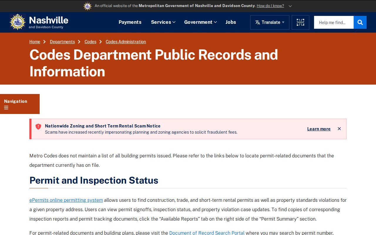
Use the form’s ZIP field as one filter, then compare the address and map/parcel result. That extra comparison matters where delivery areas cross a county edge or include institutional land.
Davidson County ZIP Address Terms
Postal and property systems label the same place in different ways. A deed is keyed to its parties and legal description, assessment data uses the parcel and address, GIS stores geometry, and USPS manages delivery. Keeping the labels distinct prevents an old mailing address or a ZIP label from being treated as title evidence.
- ZIP code and ZIP+4
- A ZIP code identifies a delivery area. ZIP+4 adds a more specific delivery segment for a complete address and must be checked address by address.
- PO-box ZIP
- A ZIP used for a post-office box or special postal use may not describe a street-delivery area.
- Unique ZIP
- A unique-use ZIP serves an institution or specialized location. It is not a proxy for a whole neighborhood.
- Carrier route
- A carrier route is the delivery path used by postal service. It can differ from parcel, census, or neighborhood boundaries.
- Situs address
- The situs address is the physical property location used in assessment work. It can differ from a mailing address.
Davidson County Unique ZIP Codes
Downtown ZIP geography includes ordinary delivery areas alongside special-purpose labels. Metro’s map identifies 37227 for Metro postal, PO-box, or institutional use, 37232 as institutional or university use, 37240 for Vanderbilt institutional use, and 37243 for the state-government campus. Those labels can place a record in the downtown area without identifying a typical home-delivery block.
A ZIP-wide GIS result may also contain government, university, commercial, or vacant parcels. Check the parcel classification, address, and legal description before making an address-level conclusion. The county field is especially important for edge ZIPs that share a delivery geography with another county.
Davidson County ZIP Map Limits
No official source inspected supplied a verified historical ZIP split or realignment table for Davidson County. The responsible approach is to describe the Metro map as November 2017 coverage and then verify the exact address through USPS. ZIP polygons can change, and carrier routes do not have to match a parcel polygon.
This county’s Metro, city, neighborhood, and postal labels are not interchangeable. A parcel in Bellevue, Donelson, Hermitage, Antioch, or an outer county area can require a ZIP check, a GIS check, and a county check before it is placed in a record search. That three-part check is more reliable than treating the city name on a mailing label as a jurisdiction.
Note: Keep the ZIP as a filter and cross-check it with street, parcel, city, and legal-description information before relying on a result.
Confirm Davidson County ZIP Codes
The Davidson County ZIP code directory works best as a careful starting point. USPS confirms delivery, the Parcel Viewer confirms the parcel and map context, the Assessor confirms the current property roll, and Codes can add address-linked permit material. Each source answers a narrower question than a broad ZIP search.
For the property roll, use the Metro Nashville/Davidson County Assessor of Property Search. Its short search supports a property address, owner name, or parcel ID. The data is for property-tax purposes and is not a certified deed, so recorded title questions belong with the Register of Deeds and its land-record portal.